Introduction
This is an analysis centred in the evaluation of landscaping as observed from Finns Reserve and Yarra River Valley Park. These two facilities play essential roles associated with serving the public through enhancing such leisure activities as playing and advancing the social core of people within the society. In fact, their features and strategic location that expose them to their public market facilitate their ultimate goals. Furthermore, their landscape takes vital ecological functions from manmade facilities as well as natural landforms and ecosystems, which are core facilitators in sustainable development. In this light, this report will provide an analysis of the provided landscape in respect to the three vital elements namely structure, function and change. Furthermore, its practical applications will expound the knowledge on principles of landscape ecology.
Study Area
The attention of this research will be centred on the mentioned reserve and park, which are located in Templestowe within Melbourne. The resources harbour an annual rainfall of between 640 mm to 660 mm, where the alluvial plains experience variety of uses including recreational centres, parking sites, exercise and training facilities, and area for preservation of natural fauna and flora among others.
Methods
The data used to evaluate these regions was retrieved through the assistance of Google images from aerial satellite view, eye observations while walking across the area, and evaluating images collected during field work as well as other reliable sources from the internet.
Discussion
The structure of the landscape
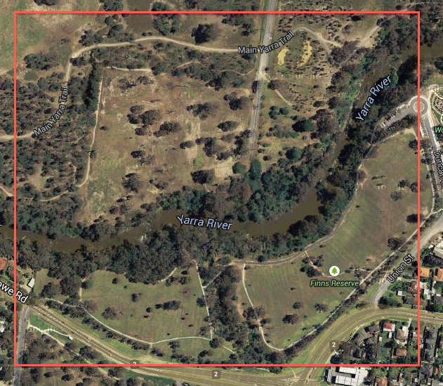
According to Finns reserve (2014), the study area occupies more than 25 hectares incorporating the two facilities. The boundaries of this area are marked by Main Yarra Trail to the northern region, Duncan Street to the east, Templestowe to the south, and the residential area on the Greenslopes drive to the west.
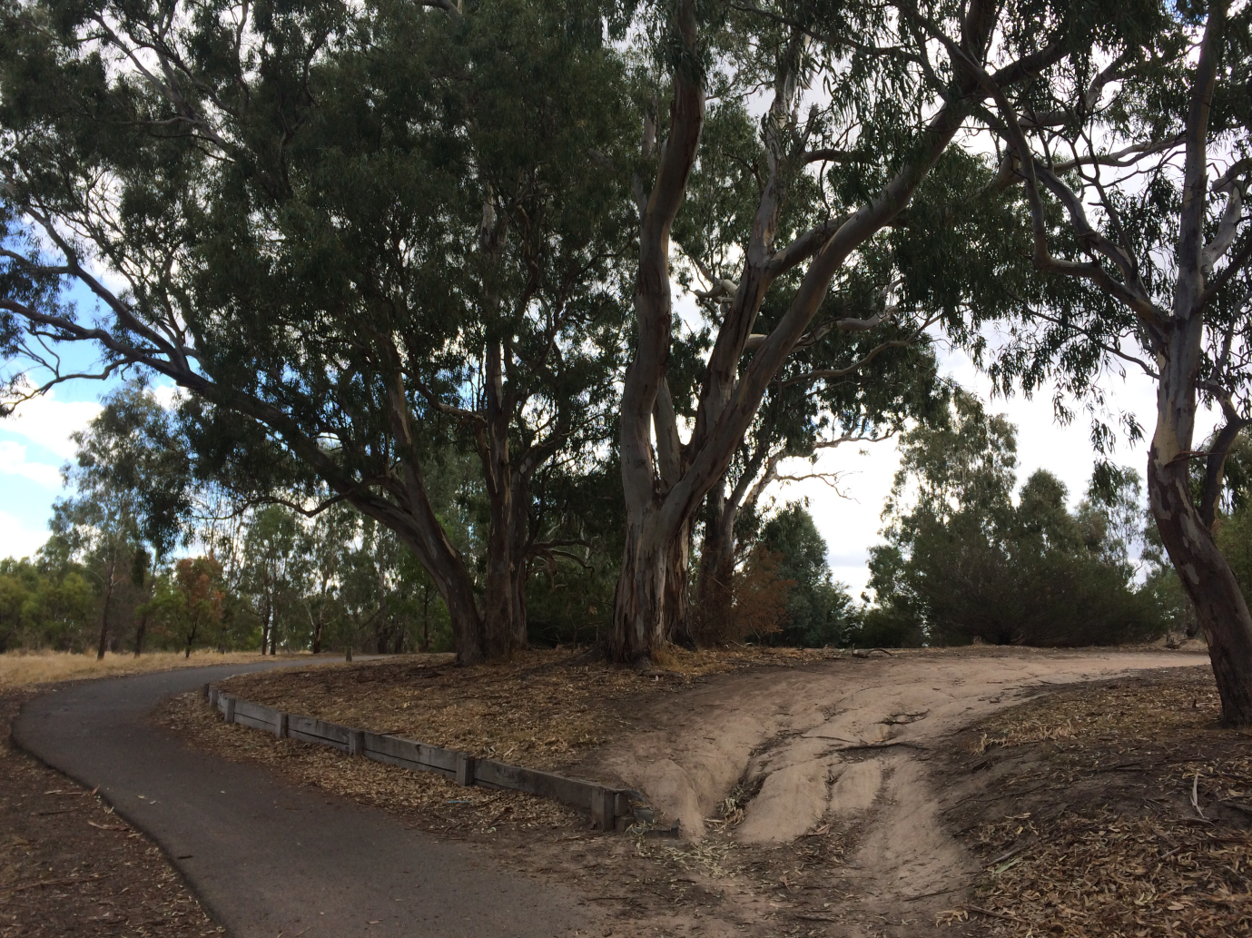
The major portion of this area is flattened even though there are some few and small hills as well as the valley of the river Yarra. It shows little deviations in terms of topography especially because the land elevations do not differ by more than 5 meters. Moreover, there is a minimum distraction of natural resources through human activities such as constructions. The highly productive and fertile soil allows existence of varieties of plant species including the herbaceous plants, shrubs and trees. In this regard, the region is protected against poor environmental conservation attributed to human activities that leads to inconsiderate negative impacts on the area.
However, the ground cover is much smaller since there are few trees in the area. The greatest ground cover has been recorded alongside Yarra River due to the adequate provision of water and other tree growth factors from the uplands. On the other hand, the presence of wild animals near this region is limited to low numbers as people settle in these regions.
An annual rainfall of 640-660 mm characterized by a suitable balancing between dryness and wetness makes the region a suitable place human leisure and other activities. Essentially, the rains commence in April and ceases around June as stipulated by climate data online (2014). In addition, this region experiences average seasonal climates where winter is gentle and summer is hot. Yarra River acts as the sole watercourse for the water from rain and that from the uplands.
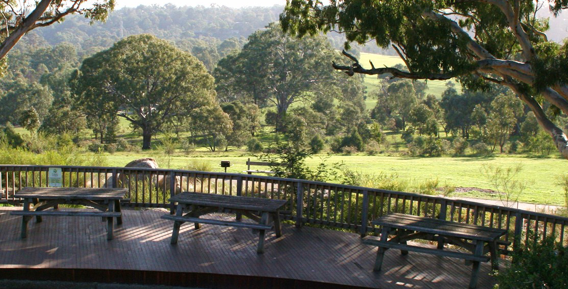
There are various outstanding features within the landscape being evaluated, which does not only include the natural plants, but also planted trees and other resources for human uses. These resources include the fields for playing, shelters, and others for leisure activities. There are patches representing the playground and other areas that are not covered by trees. Aerial map representation shows them in a more uniform color. Technically, natural patches are irregular as compared to the regular ones, which are manmade. The regular ones can be rectangular, squared circled or oval depending on the nature of their use. In this light, it can be indicated that this region is heterogeneous and appropriate for this analysis.
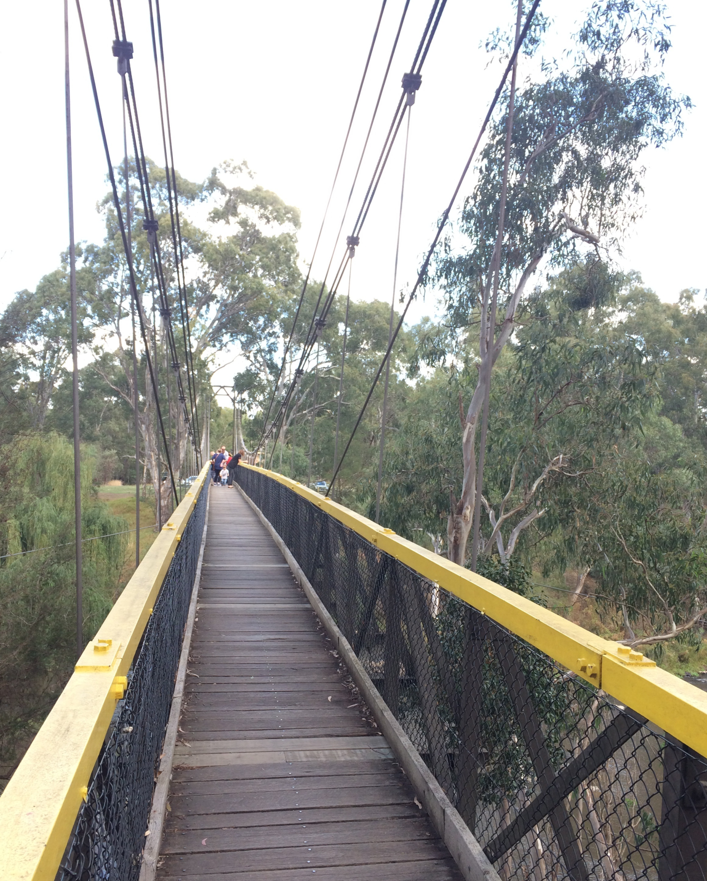
This landscape has varieties of manmade and natural linear strips exemplified by the Yarra River and walking paths. The Yarra River linear strip starts at the eastern side and heads towards the north-west region. Other observed strips include paths for hiking and biking. The river is the only natural linear strip observed in this region since the others are made by people. The later are narrow and often short as compared to the natural ones.
Yarra River Valley Park has a characteristic land mosaic identified through the attributes such as forest, fences, roads, parking areas and recreation areas. In accordance to the aerial and observation made from the field, it can be estimated that more than 50% of the study area is subject to human activities, while less than 50% harbors natural vegetation as the attribute of the landscape.
The Function of Landscape
The major role of the landscape under study is recreation activities. It is a place where families and friends visit to rest and enjoy during their leisure leading to profit accumulation. Furthermore, it is an area where landscape provides structures suited for hiking and biking. Tree planting and maintenance to natural forest is a pertinent step in securing water sources and filtering particles from air. Finally, the fertile black soil makes this landscape productive leading to perpetuation of plants and animals through reproduction.
The Flow of the Landscape
The hydrology of an area is related to the regional water movement where ground water returns to it during the rainy period. Therefore, water showers and leaves through evaporation or drainage to the Yarra River in this region. This stipulates that rain is a critical factor to the productivity of the landscape when exempting other sources made by people. The draining water collects in streams that arise during the rainy season and cease during dry spell.
This water collects altogether in the Yarra River. However, the use of land by people has affected the natural flow of water towards the river through the improvisation of trenches and buildings that lead to changes in its course. Literature has it that areas near Yarra River are usually submerged during the heavy rains especially in the month of April (Byrne, 2000). This implies that flooding is an evident case in such times, which appears at the park and reserve as well as other close areas.
The Changes in Landscape
There are various landscape manipulations from the earlier natural state of this area. The most pertinent landscape changes are attributed to the constructions and buildings. Primarily, these two factors were established to perfect the state of the field for its recreation roles. In this respect, there is dilution of the parks’ natural attributes through aspects such as parking of cars, establishing reliable picnic grounds and sceneries, creating playing grounds, and building houses for other functions. These changes can be estimated to have grown adversely since 1994.
According Otto (2005), the area did not harbour any form of infrastructure for leisure activities in a span 50 years. However, this literature stipulates that similar functions as the prevailing ones were evident in this area. These roles included acting as a field for sporting activities, resting, and business. As postulated by Pringle (2006), it had adequate natural scenarios as compared to today’s infrastructures and landscape changes.
The assessment of Mattar (2008) points out that the prevailing Finns Reserve was the location to the popular James Finn’s hotel as well as a non-residential area since around the year 1922. These can be estimated at a span of 100 years.
The principle factors affecting the deviation within this area for this span are anthropological and economic factors. For instance, the Manningham community and utilises the clear areas near the river for leisure and social aspects where people interact with others. Finally, the Finns Reserve is utilised as a source of funds used to finance the community budgets of this region.
There are various changes depicted in the future including such factors as infrastructures and influence of time. Essentially, factors such as population increment as perceived in the current statistics imply that more infrastructures are pertinent in this park. Moreover, environmental sciences and other concerned governmental organization recommend the planting of indigenous trees for environmental conservation. Furthermore, it is possible that the recreation business will expound to cover the area with more structures. In this light, the increasing population will require more or adequate facilities for parking, family and personal rest
References
Byrne, D 2000, Australia, 10th ed., Lonely Planet, Melbourne. Web.
Climate data online 2014. Web.
Finns reserve 2014. Web.
Mattar, Y 2008, ‘Post-industrialism and Silicon Valley as models of industrial governance in Australian public policy’, Telematics and Informatics, vol. 25 no. 4, pp. 246-261. Web.
Otto, K 2005, Yarra: a diverting history of Melbourne’s murky river, Text Pub, Melbourne, Australia. Web.
Pringle, J 2006, Beyond Melbourne, Edmonton, Alta. Web.
Appendix 1
Appendix 2
Appendix 3
Appendix 4